
Garmin eTrex SE
4.2Editor score
Long battery life
Multi-GNSS support
Water-resistant design
Navigating the open water requires precision and reliability. A dedicated GPS for Sailing helps captains plot courses, track waypoints, and ensure safety during voyages. Modern devices offer advanced charting and satellite support for enhanced performance.
We evaluated ten leading models based on accuracy, battery life, and marine-specific features. Our analysis covers handheld units and fixed chartplotters suitable for various vessel sizes. Each product was selected for its proven track record in marine environments.
Every pick highlights key strengths and potential trade-offs for informed decisions. Prices and availability fluctuate regularly so verify current offers before purchasing. Trust these insights to equip your boat with dependable navigation technology for safe travels.
4.2Editor score

4.0Editor score

5.0Editor score
As an Amazon Associate we earn from qualifying purchases.
This side-by-side comparison highlights the core specifications and capabilities of each selected device. Use this table to quickly identify which unit matches your specific sailing needs and budget constraints.




The Garmin GPSMAP 79sc stands out as a premier handheld option for sailors seeking reliability and charting capabilities. With a 4.0 rating, it offers a rugged build that floats and features preloaded BlueChart g3 coastal charts essential for marine navigation. Its high-resolution color display ensures visibility even in bright sunlight conditions common on open waters.
We may earn a commission when you buy through this link, at no additional cost to you.
This device supports multiple satellite constellations including GPS GLONASS Beidou Galileo QZSS and SBAS for reliable tracking around the world. The increased memory allows you to save and track up to 10000 waypoints 250 routes and 300 fit activities ensuring you never lose your path. A built-in 3-axis tilt-compensated electronic compass shows heading while standing still providing critical orientation data.
While the unit is water-resistant at IPX6 level only the floating design adds a layer of safety against accidental drops overboard. The barometric altimeter tracks changes in pressure to pinpoint your precise altitude which can be useful for understanding weather patterns. Battery life reaches up to 20 hours in GPS mode supporting extended voyages without frequent recharging.
Sailors who need a durable handheld with integrated charting should prioritize this model for its balance of features and portability. It is particularly suited for day trips or as a backup unit on larger vessels where primary navigation systems are already installed. The combination of floating capability and detailed coastal mapping makes it a smart investment for safety and convenience.
Supporting multiple satellite constellations ensures you maintain accurate tracking even in challenging environments where signals might be obstructed.
The device is designed to float if dropped in water and features a rugged build to withstand the harsh marine environment.
We may earn a commission when you buy through this link, at no additional cost to you.
The Garmin GPSMAP 65s delivers exceptional accuracy with its multi-band technology and expanded global navigation satellite systems support. Boasting a 4.6 rating this button-operated handheld features a large 2.6 inch sunlight-readable color display that makes viewing easy even in bright conditions. It includes routable TopoActive mapping and federal public land maps which are useful for coastal exploration and ashore adventures.
We may earn a commission when you buy through this link, at no additional cost to you.
You can rely on this device for go-anywhere navigation thanks to its 3-axis compass and barometric altimeter features. The expanded satellite support allows you to get optimal accuracy in challenging locations including steep country urban canyons and forests with dense trees. Compatibility with the Garmin Explore website and app helps you manage tracks routes and waypoints while reviewing statistics from the field seamlessly.
Although primarily designed for broad navigation the rugged build ensures it can handle marine use if kept secure. The display size and resolution provide clear visibility for reading data points during critical navigation moments. Battery performance is solid for extended trips though users should carry spare batteries for longer expeditions beyond the expected range.
This unit is ideal for sailors who also enjoy land-based activities or need precise tracking in varied terrain. The high rating reflects its reliability and the user-friendly interface that simplifies complex navigation tasks. While it lacks the specific floating trait of some marine models its robust performance makes it a versatile choice for diverse outdoor needs.
Multi-band technology allows for optimal accuracy in challenging locations by utilizing multiple frequencies to reduce signal interference.
The large 2.6-inch color display is designed for easy viewing even in bright sunlight ensuring clear visibility on deck.
We may earn a commission when you buy through this link, at no additional cost to you.
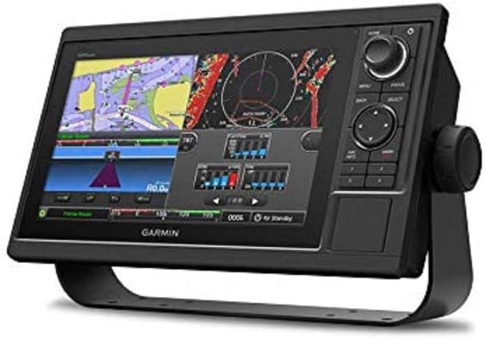
The Garmin GPSMAP 1022 is a robust fixed unit designed for serious boaters needing a large screen and network connectivity. With a 4.5 rating it features a 10.1-inch diagonal WSVGA display with a resolution of 1024 x 600 pixels for crisp detailed navigation views. The physical dimensions of 12.5 x 7.3 x 2.7 inches fit standard marine dashboards while supporting dual SD card slots for expanded chart storage.
We may earn a commission when you buy through this link, at no additional cost to you.
Two Garmin Marine Network ports allow you to integrate this plotter with compatible radar sonar and other marine electronics on your vessel. The included worldwide basemap provides immediate access to global positioning data upon setup without needing additional card purchases. This setup ensures that your primary navigation system is ready for long voyages across different ocean regions and coastal waters.
While this device is not handheld it offers the stability and screen real estate necessary for detailed route planning and monitoring. The network ports facilitate data sharing across the boat enabling a comprehensive situational awareness system. Installation requires more effort than a handheld but the benefit of a permanent high-resolution display is significant for larger boats.
Boaters looking for a main helm display with expandable features will find this model highly capable. The high resolution and network compatibility make it a future-proof choice for evolving marine electronics ecosystems. It serves as a cornerstone for advanced navigation setups where reliability and screen clarity are paramount for safe passage.
The WSVGA display offers high resolution for clear viewing of charts and waypoints during navigation.
Two marine network ports allow integration with other devices to create a comprehensive marine electronics system.
We may earn a commission when you buy through this link, at no additional cost to you.
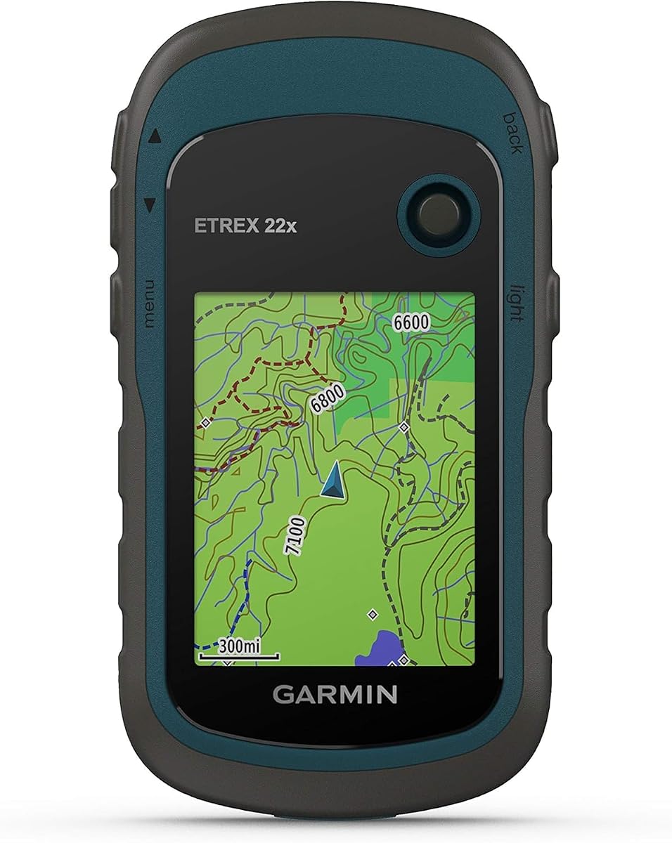
The Garmin eTrex 22x offers a rugged handheld solution that performs well for outdoor navigation including coastal sailing. With a 4.3 rating it features a 2.2-inch sunlight-readable color display that provides improved readability for your tracking activities. Preloaded with Topo Active maps it supports GPS and GLONASS satellite systems allowing for tracking in more challenging environments than GPS alone.
We may earn a commission when you buy through this link, at no additional cost to you.
You get 8 GB of internal memory for map downloads plus a micro SD card slot to expand your storage capacity as needed. The battery life reaches up to 25 hours in GPS mode with 2 AA batteries ensuring longevity during extended days on the water. Its durable design protects against elements making it suitable for rough weather conditions often faced by sailors.
While this unit is primarily marketed for hiking and cycling the GPS capabilities translate well to general navigation tasks. The compact size allows it to fit easily in a pocket or glove box without taking up much space. Users appreciate the balance between affordability and performance for those needing a reliable backup without advanced marine charting.
This model is recommended for budget-conscious sailors who need a solid GPS tracker for position monitoring. It is not a full chartplotter but serves effectively as a tool for verifying coordinates and tracking progress. The long battery life and expandable memory make it a practical addition to any onboard emergency or navigation kit.
Battery life lasts up to 25 hours in GPS mode using two AA batteries for long days without recharging.
Support for GPS and GLONASS allows for tracking in more challenging environments than GPS alone.
We may earn a commission when you buy through this link, at no additional cost to you.
The Garmin GPS 73 is designed with specific sailing features that make it a strong contender for competitive or recreational sailors. With a 4.4 rating it includes SAILASSIST features such as virtual starting line countdown timers speed history and tack assist. The device operates for 18+ hours on 2 AA batteries and offers marine features like MOB anchor drag alarms and route planning.
We may earn a commission when you buy through this link, at no additional cost to you.
Its intuitive user interface with dedicated backlit buttons allows for quick and easy operation even in low light conditions. The unit stores up to 1000 waypoints and 100 tracks that help you get back to your favorite spots or fishing grounds. This storage capacity is essential for sailors who regularly revisit specific locations during their voyages.
Although the screen size is smaller than modern chartplotters the focus on sailing utilities provides distinct advantages for racers. The inclusion of MOB alarms and anchor drag alerts enhances safety by notifying you of critical events immediately. It remains a functional tool for those who prioritize sailing-specific data over large map displays.
Sailors looking for a dedicated handheld with sailing aids should consider this model for its specialized capabilities. It balances basic navigation with tools that directly support sailing maneuvers and safety protocols. The straightforward design ensures that you can access critical information quickly when every second counts on the water.
Includes virtual starting line countdown timers and tack assist to support competitive and recreational sailing needs.
Offers marine alarms including man overboard and anchor drag alerts to improve safety on the water.
We may earn a commission when you buy through this link, at no additional cost to you.
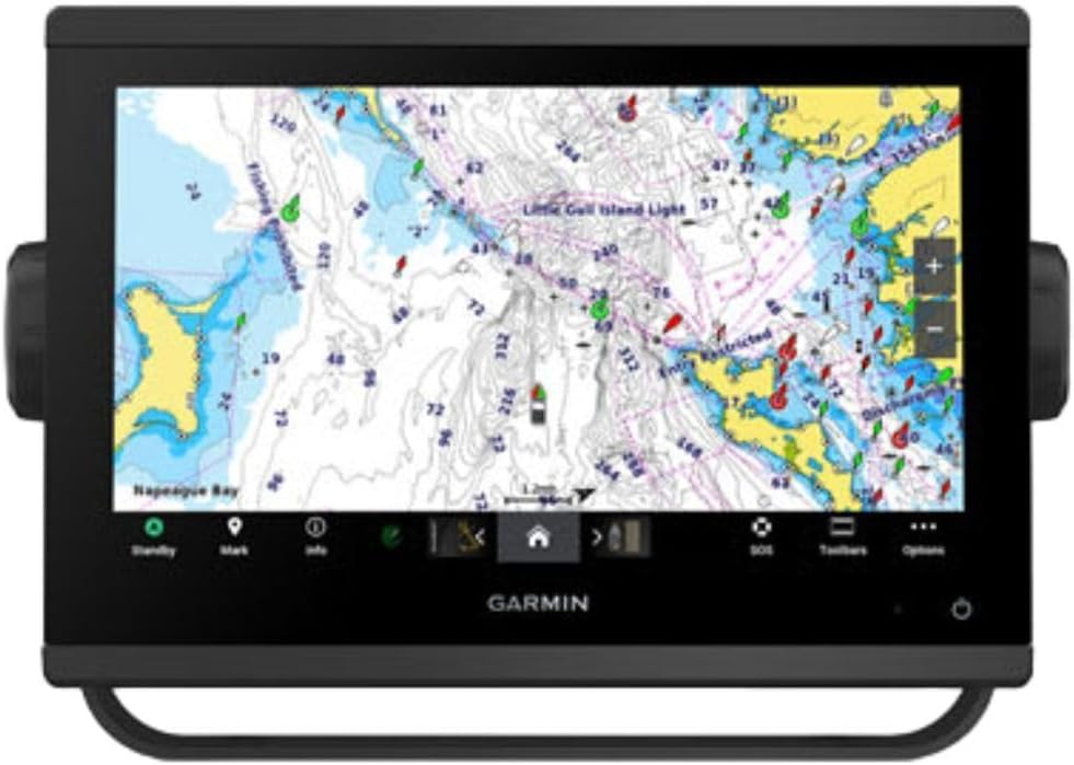
The Garmin GPSMAP 9210 represents the pinnacle of marine navigation technology with a premium 10-inch chartplotter design. With a 5.0 rating it features a full HD display and glass helm edge-to-edge design for a seamless modern look. Processing power is up to 7 times faster than previous generations ensuring superior performance when running complex navigation software or charts.
We may earn a commission when you buy through this link, at no additional cost to you.
Enjoy premium sailing features such as sailing polars plus see laylines race start line guidance and more with Garmin SailAssist features. The unit uses the NMEA 2000 and NMEA 0183 networks to connect to your compatible autopilots sensors and more seamlessly. Connectivity is enhanced by 5GHz Wi-Fi providing faster wireless ActiveCaptain app transfer speeds for quick data updates.
Build extensive networks with reliable connectivity and gigabit speeds on the Garmin BlueNet network for optimal data sharing. The device supports EmpirBus system and other third-party solutions via OneHelm integrated digital switching for advanced control. Keep tabs on engine performance with extensive engine integration including SAE J1939 connectivity and a wide range of support for outboard engine manufacturers.
This chartplotter is ideal for serious sailors and vessel owners who demand the highest level of performance and integration. The combination of display quality processing speed and sailing features makes it a top choice for modern boat setups. While the cost is high the functionality and reliability justify the investment for those seeking a complete navigation hub.
Includes sailing polars laylines and race start line guidance for enhanced race and performance sailing.
Processing power is up to 7 times faster with 5GHz Wi-Fi for rapid data transfer and app updates.
We may earn a commission when you buy through this link, at no additional cost to you.
The Garmin GPSMAP 79s is a rugged handheld GPS designed to float in water ensuring it stays accessible if dropped overboard. With a 4.2 rating it includes worldwide basemap and supports multiple satellite constellations for reliable tracking around the world. The scratch-resistant fogproof glass provides clear visibility and durability in harsh marine conditions where clarity is essential.
We may earn a commission when you buy through this link, at no additional cost to you.
Increased memory allows you to save and track 10000 waypoints 250 routes and 300 fit activities with ease. A built-in 3-axis tilt-compensated electronic compass shows heading while standing still offering accurate direction even when the vessel is stationary. The barometric altimeter tracks changes in pressure to pinpoint your precise altitude which can assist with weather interpretation.
Battery life reaches up to 20 hours in GPS mode supporting long days of navigation without needing frequent charging. The water-resistant rating of IPX6 protects the unit level but should be used with care in wet environments. This balance of features makes it a versatile tool for sailors needing a backup or primary handheld navigator.
Users should prioritize this device if they require a dependable floating handheld with robust compass and tracking capabilities. It is well-suited for kayaking dinghy sailing or as a secondary navigator on larger vessels. The worldwide basemap covers basic needs while offering the freedom to add detailed charts if necessary.
Rugged design floats in water preventing loss if accidentally dropped overboard during sailing activities.
Built-in 3-axis tilt-compensated electronic compass shows heading while standing still for accurate direction.
We may earn a commission when you buy through this link, at no additional cost to you.
The Garmin GPSMAP 943xsv combines chartplotter functionality with advanced sonar capabilities for comprehensive marine navigation. With a 4.7 rating it features ultra high-definition scanning sonar and Panoptix sonar support to detect underwater structures and marine life. The pre-loaded mapping provides immediate access to regional charts so you can start navigating without delay upon installation.
We may earn a commission when you buy through this link, at no additional cost to you.
Improved display optics enhance the viewing experience ensuring that sonar returns and chart details are clear even in bright conditions. This unit is designed to offer precise depth and structural data alongside standard GPS navigation for a complete situational view. It connects to compatible marine networks allowing you to integrate it into your existing electronics ecosystem seamlessly.
While the focus includes significant sonar capabilities the chartplotter aspect ensures you stay on course safely. The high resolution optics make it easier to interpret complex underwater data quickly during critical navigation moments. Users appreciate the dual purpose nature of the device which reduces clutter by combining navigation and fish finding tools.
Anglers and sailors who need both map plotting and high-quality sonar will find this model highly effective. It is a powerful option for coastal navigation where knowing the underwater topography is as important as knowing your path. The integration of these features supports a proactive approach to route planning and safety.
Ultra high-definition scanning sonar provides detailed views of underwater structures and marine life.
Pre-loaded mapping allows for immediate chartplotter use without needing to purchase additional chart cards.
We may earn a commission when you buy through this link, at no additional cost to you.
The Garmin eTrex 10 is a rugged handheld navigator with a preloaded worldwide basemap and a 2.2 inch monochrome display. With a 4.3 rating it features a WAAS enabled GPS receiver with HotFix and GLONASS support for fast positioning and a reliable signal. Waterproof to IPX7 standards it provides protection against splashes rain and other water hazards common on boats.
We may earn a commission when you buy through this link, at no additional cost to you.
You can support paperless geocaching and use Garmin spine mounting accessories to secure the unit to your vessel. Power with two AA batteries for up to 20 hours of use which ensures you stay active during extended voyages. The device allows you to see high and low elevation points or store waypoints along a track for better route management.
While the display is monochrome it remains functional and easy to read in various lighting conditions. The worldwide basemap covers enough ground for general navigation and tracking without the need for extra chart purchases. Its robust waterproof rating makes it reliable for outdoor use where rain or spray is a constant possibility.
This unit is ideal for budget-focused sailors who need a basic yet reliable tracker for their trips. It serves well as a secondary device for position monitoring when primary systems are in use. The simplicity of operation ensures you can focus on sailing rather than navigating complex menus or settings.
Waterproof to IPX7 standards for protection against splashes rain and other water exposure hazards.
WAAS enabled GPS receiver with HotFix and GLONASS support for fast positioning and a reliable signal.
We may earn a commission when you buy through this link, at no additional cost to you.
The Garmin eTrex SE features a 2.2-inch high-resolution display that is easy to read even in bright sunlight conditions. With a 4.2 rating it offers a long battery life of up to 168 hours in standard mode and up to 1800 hours in expedition mode with 2 field-replaceable AA batteries. Pair with the Garmin Explore app on your compatible smartphone for wireless software updates trip planning and smart notifications.
We may earn a commission when you buy through this link, at no additional cost to you.
Get automatic cache updates from Geocaching Live including descriptions logs and hints when paired to the Garmin Explore app on your compatible smartphone. Multi-GNSS support gives access to multiple global navigation satellite systems to track in more challenging environments than GPS alone. Plot your bearing with the digital compass which provides an accurate heading even when stationary for better orientation.
Hike in any weather with the water-resistant design rated to IPX7 ensuring protection against rain and splashes on deck. The device balances long battery life with advanced satellite support making it suitable for extended navigation tasks without frequent charging. Its compact size makes it easy to carry and access whenever navigation data is needed quickly.
This unit is perfect for sailors who prioritize battery longevity and reliable GPS support over advanced map features. It is a practical tool for tracking position and sharing data with partners via the Explore app. The combination of water resistance and long life makes it a reliable partner for long trips where power is limited.
Battery life reaches up to 168 hours in standard mode with two field-replaceable AA batteries.
Multi-GNSS support gives access to multiple global navigation satellite systems for tracking in more challenging environments.
We may earn a commission when you buy through this link, at no additional cost to you.
Selecting the right GPS for sailing depends on your vessel size, budget, and specific navigation needs. Consider these factors to find a device that ensures safety and accuracy.
The display is the primary interface for your navigation data so clarity and size are paramount. For handhelds, a sunlight-readable screen ensures you can see coordinates without squinting in bright conditions. Chartplotters benefit from larger high-resolution displays that allow for detailed chart views alongside system info.
Prioritize screens with high brightness settings and anti-glare coatings to maintain visibility on deck during the day.
Battery life is critical for handheld units used during multi-day trips or emergencies. Look for models that offer at least 20 hours of use on standard AA batteries to reduce reliance on charging cables. Fixed units draw power from the boat, but backup battery options are useful for emergencies.
Choose devices with efficient power modes or replaceable batteries to ensure continuous operation when away from shore power.
Some devices come with preloaded charts while others require purchasing separate cards for specific regions. Verify that the unit supports the marine charts you plan to use for your sailing routes. Compatibility with standard map formats allows you to update data easily over time.
Ensure the chosen GPS supports the map formats necessary for your sailing area to avoid costly or complicated updates later.
Marine environments expose electronics to saltwater humidity and physical impacts so durability is non-negotiable. Look for IPX7 or IPX6 ratings that guarantee protection against splashes rain or accidental drops. Floating designs add a layer of safety for handheld units used near water's edge.
Select a device with a rugged build and waterproof rating to ensure it survives harsh weather conditions on the water.
Modern GPS units often support multiple satellite constellations like GPS GLONASS and Galileo for better accuracy. This support helps maintain a signal in challenging environments where a single system might struggle to lock on. Check the specs to ensure the device covers the regions where you plan to sail.
Choose models with multi-constellation support to guarantee reliable tracking regardless of geographic location or atmospheric conditions.
Advanced sailors may need to connect their GPS to autopilots radars or other sensors via NMEA ports. Fixed chartplotters usually offer these ports while handhelds may rely on Bluetooth for app connectivity. Ensure the unit fits into your existing electronics ecosystem without requiring extra adapters.
Verify that the device supports the connectivity standards required for your marine network to enable seamless data sharing.
Some models offer specific tools like virtual starting lines tack assist or sailing polars for racing. These features can significantly enhance performance and safety for competitive sailors. Standard units might lack these tools but can still serve well for general navigation needs.
Decide if specialized tools like tack assist are necessary for your sailing style before choosing a premium model.
The amount of internal memory determines how many waypoints routes and tracks you can store on the device. Expandable storage via SD cards offers flexibility for adding detailed maps without upgrading hardware. Adequate storage prevents data loss during long voyages where you may want to log many points.
Look for devices with ample internal memory and SD card slots to manage large amounts of navigation data effectively.
Begin by inserting charged batteries or connecting the device to a power source. Follow the on-screen setup to select your preferred units and map style. Ensure you are in an open area to establish a strong satellite lock before heading out.
Keep the lens of the device clean and free from salt spray or debris that could obscure the display. For handhelds, use a lanyard or secure mount to prevent accidental drops overboard during rough weather. Regularly update the software to access the latest maps and feature improvements.
When the trip is finished, wipe the unit with fresh water to remove salt residue and dry it thoroughly. Store the device in a dry place away from direct sunlight to preserve battery health. Check battery levels before every use to ensure reliable performance on the water.
A handheld GPS is portable and often floats making it easy to carry around the boat. A chartplotter is usually fixed to the helm and offers a larger screen with advanced connectivity for full boat systems.
Some units come with preloaded basemaps or coastal charts while others may require buying separate memory cards. Always check the product description to confirm what is included before purchase.
Most handhelds offer between 20 to 168 hours of battery life depending on the mode and settings. Fixed units rely on your boat's power system so battery is rarely a concern for them.
Many models are rated IPX6 or IPX7 which means they can withstand rain and splashes effectively. However, full submersion protection should be checked as not all floating devices are rated for deep water.
Yes most handheld models support both marine and land navigation maps for versatile use. Some units come with Topo maps which are useful for hiking near coastal areas.
SAILASSIST is a feature set that includes tools like virtual starting lines and tack assist. It is designed to help racers and serious sailors optimize their performance and strategy on the water.
We reviewed ten top-rated GPS units that cover a wide range of sailing needs from budget handhelds to premium chartplotters. Each device offers unique strengths such as long battery life floating designs or specialized sailing tools to enhance your voyage.
Prioritize features that match your specific sailing style and vessel size to get the most value from your purchase. Whether you need basic tracking or advanced charting ensure the device supports your safety and navigation goals.
Remember that prices and availability can change so check current offers before finalizing your decision. With the right GPS in hand you can sail with confidence and explore new waters safely.